This is a little detour from my series on congestion, but it’s a typical example about how your city chooses and prioritizes more cars or bikes, as well as how even a highly-praised bicycle city still chooses more cars. - Lars Barfred. Denmark’s most car-congested, mixed-use road is the six lane wide Hans Christian Andersen Boulevard *. It caters to 56,000 motor vehicles a day, which is also close to its peak capacity. It also also has 21,000 daily bicycle user.
It cuts through two densly populated residential neighbourhoods, Frederiksberg and Nørrebro, and slices through the coveted area around The Lakes, past another residential area, onwards past the City Hall Square and Tivoli Gardens and then passes over the harbour. The harbour is no longer a merchant harbour (the original name for Copenhagen - København in Danish - was Køpmannæhafn or Merchants Harbour) but rather a recreative area that is now clean enough for swimming. It ends up roaring past the old fortress bastions of Copenhagen and cutting it off from the residential neighbourhood of Islands Brygge.
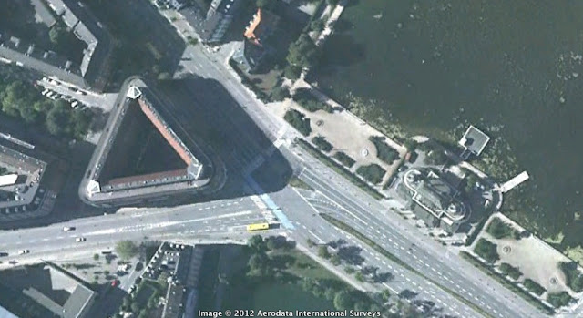
The area of interest, The Lakes of Copenhagen |
By all measures it is as damaging to this city’s liveability as any road in the world. Even the Dutch National Bicycle Council, in their review of Copenhagen found it bizarre that this street is allowed to exist in the heart of the city. At The Lakes, the city is developing a green bike route along the full length of the water, part of a east-west bicycle artery - ‘Sø-ruten’, which is a great idea and which will connect the Østerbro neighbourhood with the Bryggebroen harbour bridge to Amager. The city guesstimates that the route currently has 5000 bicycles a day and that will probably rise to 10-15,000 when finished.
The intersection at The Lakes - which is a T-intersection for cars and actually a penta-section (5 paths/roads meet here) has long been optimised for car through-put and has long been incredibly lousy for the 5000 + bicycle users who are forced to stop and walk their bike across pedestrian crossings.
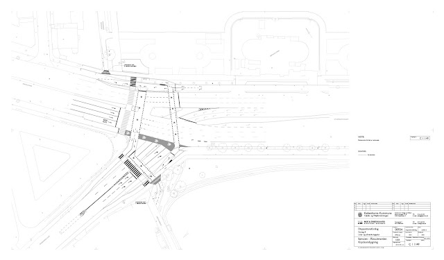
The Best Solution - As it should have been
The consulting firm who won the assignment made nine proposals for the intersection. Several proposals could easily have made the intersection more convenient and safer for bicycle users - and at a low cost - by providing an ordinary crossing and much less waiting time. The latter is the most irritating for bicycle users. At many major intersections in the city they still have to wait unreasonably long, sometimes waiting for two lights before heading straight on. This is because many of these intersections are still optimized for car through-traffic and right turn car capacity - at the expense of bicycle trip duration.
The decision was an easy one for the Copenhagen DoT. It was good and inexpensive and would have reduced as much as 15% of car capacity so that meant it was Dead on Arrival. This argument won over the Copenhagen Police (who bizarrely have a say in such matters) in a flash - quicker than accepting a proposal for Porsche patrol cars for their officers. I am told that the Copenhagen Police have a spotless track record of never having questioned a solution that would maintain or improve car capacity or higher speed limits. The Chosen Solution - What we’ll end up with
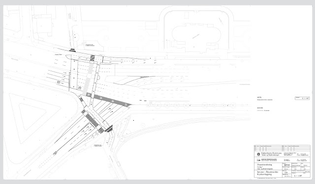
Click for a larger version The City chose instead the above solution, which will decrease bicycle capacity by 15% and which will force the 26,000** daily bicycle users to cross each others paths at one or both of two points in the crossing, instead of a a traditional distribution of four points. This means the intensity, the sense of safety and the chance of collision will increase. These important points were not even considered by the City. The Head of the Bicycle Office actually told me to my face that they had, in her mind, chosen the best solution.
One could argue that Hans Christian Andersen Boulevard, though misplaced, is one of the main arteries in Copenhagen for cars. It is, however, also important for bicycle traffic which is supposed to grow by 45-51% between now and 2015 - oops… I mean 2025. Whereas cars are now 20% above the level that the city decided was the maximum 15 years ago. So a 15% reduction - in the rejected proposal - would have been right on target.
You can see the current intersection in the last 30 seconds or so of this film.
Welcome to the New Copenhagen.
(* The street changes names a number of times along its length. Bispebuen, Åboulevarden, Ågade, Gyldenløvesgade and Hans Christian Andersens Boulevard, but I’ll just use the latter for clarity )
(**HC Andersen is used by 21,000 daily bicycle users, and the crossing lake route currently 5000, all in all 26,000 daily bikes at the intersection)
More articles from Lars Barfred.


