
Here’s a photo taken from the Dansk Cyklist Forbund’s book commemorating their 100th anniversary. It shows a bike lane in the suburbs on Strandvejen, the coast road north of Copenhagen, and the morning rush hour towards the city. The year is 1955. I recognize the location as being Strandvejen 215, if any one is riding past one day.Anyway, separated infrastructure, as we all know, gets people cycling. As the photo clearly demonstrates. It’s worth mentioning that this neighbourhood and the ones around it are considered quite posh. This stretch away from the city has been called The Whiskey Belt for a very long time. To distinguish the residents, not always positively in a historical context, from the beer drinking masses. So here are Denmark’s middle class to upper class commuting on bicycles to work in the city.
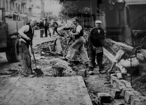
I haven't been able to find photos of the earliest examples of bicycle lanes/infrastructure, but this photo is from the 1920's and show the building of separated lanes. It's from the excellent Copenhagen by Bike exhibition at the City Museum.
 And here's a photo from the exhibition from the beginning of the renaissance of our modern bicycle culture. The reestablishment of physically-separated lanes in the 1980's after many had been dismantled due the boom in car culture.
Bicycle infrastructure is almost as old as the bicycle itself in countries like Denmark and the Netherlands. A bit younger in the UK, but still old and wise.


